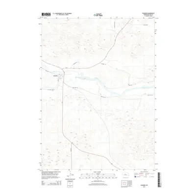
2014 Map of Dunning
USGS Topo · Published 2014About this map
Dunning serves as a central hub for the surrounding ranching landscape in this 2014 survey of Blaine County. The settlement is positioned near the significant confluence where the Dismal River joins the Middle Loup River, a geography that has long dictated the layout of local infrastructure. The map reveals a network of roads that follow the contours of the Sandhills, including Middle Loup Rd and the family-named Roseberry Rd. The town center includes the Po, providing a focal point for the rural community. This survey illustrates how modern highways like Ne-2 and Ne-91 have integrated with older, descriptively named routes such as Wild Horse Creek Rd and Cedar Tree Rd, reflecting the continued importance of river-valley transit in central Nebraska.
Find a feature on this map
15 named features on this map. Tap any name to fly to it.
Don’t see what you’re looking for? This feature index may not catch every label — zoom into the map to look around manually.
Map Details
Editions of this 2014 Dunning Map
This is the sole edition of this map. No revisions or reprints were ever made.
Other maps of this area

1948 · Linscott
USGS Topo · 1:62,500

1950 · Linscott
USGS Topo · 1:62,500

1951 · Dunning
USGS Topo · 1:62,500

1951 · Anselmo NW
USGS Topo · 1:24,000

1952 · Brewster SW
USGS Topo · 1:24,000

1952 · Brewster NW
USGS Topo · 1:24,000

1954 · North Platte
USGS Topo · 1:250,000

1955 · Broken Bow
USGS Topo · 1:250,000

1956 · Broken Bow
USGS Topo · 1:250,000

1956 · North Platte
USGS Topo · 1:250,000