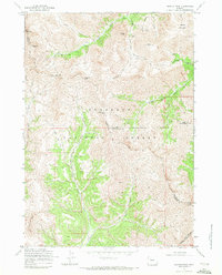
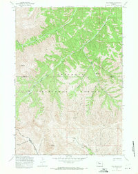
1969 Map of Dunrud Peak
USGS Topo · Published 1972About this map
The high-altitude mining and wilderness terrain of the Shoshone National Forest dominates this 1969 study, where the borders of Fremont, Park, and Hot Springs counties converge. This landscape is defined by the headwaters of the Wood River, which flows through steep drainages below peaks like Dunrud Peak and Mount Sniffel. The map reveals a specialized mining history in the northern reaches, particularly around Kirwin just off the sheet, where active prospects and sites such as the Tantalum Mine and Pickwick Mine are noted near Bald Mtn. Steep pack trails like the Wood River Trail and Cascade Creek Trail provide the only access through these high divides. In the southern portion, the Wind River Indian Res Bdy marks the transition into tribal lands, while the presence of Coal Chute Pass suggests the historical movement of resources across these formidable mountain passes.
Find a feature on this map
40 named features on this map. Tap any name to fly to it.
Don’t see what you’re looking for? This feature index may not catch every label — zoom into the map to look around manually.
Map Details
Editions of this 1969 Dunrud Peak Map
This is the sole edition of this map. No revisions or reprints were ever made.
Other maps of this area

1904 · Kirwin
USGS Topo · 1:125,000

1906 · Kirwin
USGS Topo · 1:125,000

1955 · Thermopolis
USGS Topo · 1:250,000

1958 · Thermopolis
USGS Topo · 1:250,000

1962 · Thermopolis
USGS Topo · 1:250,000

1967 · Monument Peak
USGS Topo · 1:24,000
1967 · East Fork Basin
USGS Topo · 1:24,000
1967 · Castle Rock
USGS Topo · 1:24,000
1969 · Wiggins Peak
USGS Topo · 1:24,000
1969 · Twin Peaks
USGS Topo · 1:24,000