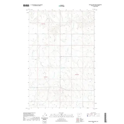
2020 Map of Duplisse Creek North
USGS Topo · Published 2020About this map
Long Grass Cr flows through the center of this Richland County landscape, providing a rare water source in a region defined by its drainage systems and ephemeral basins. The terrain is marked by essential local water features such as Fatzinger Reservoir and Candee Pond, which serve as vital landmarks in an area otherwise partitioned by the Public Land Survey System into t26n r51e and t25n r52e. The drainage pattern is complex, with Bilger Cr, Second Cr, and Muskrat Cr cutting through the northern reaches, while E Redwater Cr and the namesake Duplisse Cr anchor the southern portion. This network of named creeks and reservoirs highlights the agricultural and ranching importance of water management in eastern Montana, where rural roads like Co RD 143 and Co RD 308 follow the contours of the land to connect these remote holdings.
Find a feature on this map
16 named features on this map. Tap any name to fly to it.
Don’t see what you’re looking for? This feature index may not catch every label — zoom into the map to look around manually.
Map Details
Editions of this 2020 Duplisse Creek North Map
This is the sole edition of this map. No revisions or reprints were ever made.
Other maps of this area

1909 · Glendive
USGS Topo · 1:250,000

1912 · Poplar
USGS Topo · 1:62,500

1914 · Brockton
USGS Topo · 1:62,500

1954 · Glendive
USGS Topo · 1:250,000

1954 · Wolf Point
USGS Topo · 1:250,000

1957 · Glendive
USGS Topo · 1:250,000

1958 · Wolf Point
USGS Topo · 1:250,000

1958 · Glendive
USGS Topo · 1:250,000

1972 · Poplar
USGS Topo · 1:24,000
1972 · Mortarstone Bluff
USGS Topo · 1:24,000