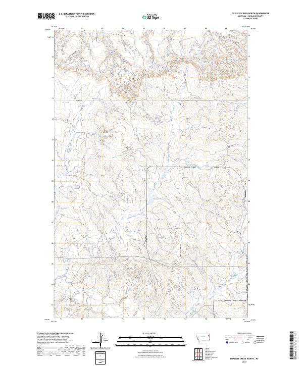
2024 Map of Duplisse Creek North
USGS Topo · Published 2024About this map
Long Grass Creek and its tributaries carve a complex drainage pattern through this section of Richland County, defining a landscape of high plains and coulees. Water management is central to the area's utility, marked by the presence of Fatzinger Reservoir in the central township and the smaller Candee Pond to the north. These features reflect the region's agricultural and ranching requirements, where seasonal flows from Muskrat Creek and Bilger Creek are critical to the local economy.
Find a feature on this map
15 named features on this map. Tap any name to fly to it.
Don’t see what you’re looking for? This feature index may not catch every label — zoom into the map to look around manually.
Map Details
Editions of this 2024 Duplisse Creek North Map
This is the sole edition of this map. No revisions or reprints were ever made.
Other maps of this area

1909 · Glendive
USGS Topo · 1:250,000

1912 · Poplar
USGS Topo · 1:62,500

1914 · Brockton
USGS Topo · 1:62,500

1954 · Glendive
USGS Topo · 1:250,000

1954 · Wolf Point
USGS Topo · 1:250,000

1957 · Glendive
USGS Topo · 1:250,000

1958 · Wolf Point
USGS Topo · 1:250,000

1958 · Glendive
USGS Topo · 1:250,000

1972 · Poplar
USGS Topo · 1:24,000
1972 · Mortarstone Bluff
USGS Topo · 1:24,000