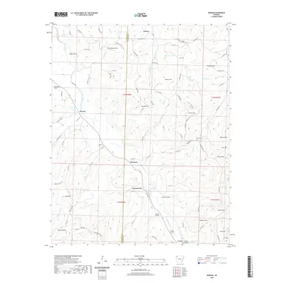
2020 Map of Durham
USGS Topo · Published 2020About this map
The White River carves a winding path through this corner of the Ozarks, serving as the primary geographic corridor for the settlements of Durham, Thompson, and Crosses. The landscape is defined by its many named peaks and ridges, including the curiously named Chicken Bristle Mtn and Bushart Mtn, which rise above narrow hollows like Ridley Hollow and Skinner Hollow. This 2020 survey captures the contemporary layout of remote mountain communities where local history is preserved in several small burial grounds such as Walnut Grove Cem, Pinnacle Cem, and Shumate Cem. The area’s rugged character is underscored by the density of high points like High Rock Mtn and Lacy Mtn, which frame the drainage basins of Cannon Creek and Fritts Creek as they flow toward the main river valley.
Find a feature on this map
105 named features on this map. Tap any name to fly to it.
Don’t see what you’re looking for? This feature index may not catch every label — zoom into the map to look around manually.
Map Details
Editions of this 2020 Durham Map
This is the sole edition of this map. No revisions or reprints were ever made.
Other maps of this area

1898 · Winslow
USGS Topo · 1:125,000

1899 · Fayetteville
USGS Topo · 1:125,000

1900 · Eureka Springs
USGS Topo · 1:125,000

1901 · Winslow
USGS Topo · 1:125,000

1901 · Eureka Springs
USGS Topo · 1:125,000

1901 · Fayetteville
USGS Topo · 1:125,000

1904 · Fayetteville
USGS Topo · 1:125,000

1943 · St. Paul
USGS Topo · 1:62,500

1945 · Harrison
USGS Topo · 1:250,000

1946 · St. Paul
USGS Topo · 1:62,500