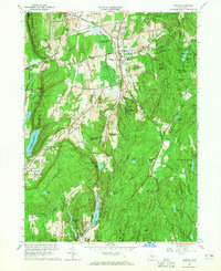
1964 Map of Durham
USGS Topo · Published 1965About this map
Durham and Durham Center serve as the primary hubs in this mid-1960s survey of Middlesex and New Haven counties. The landscape is defined by its substantial water resources and conservation areas, including the Durham Meadows Hunting Area and sections of Cockaponset State Forest. Significant topographical features like Pistapaug Mountain and Totoket Mountain frame the western edge, while the south is marked by infrastructure like the Genesee Tunnel and a prominent Aqueduct near Menunkatuck Reservoir. Educational and community life is anchored by Brewster Sch and Korn Sch, while the region's early industrial history is evidenced by Quarries and the Allyn Millpond. The New York New Haven and Hartford railroad cuts through Reed Gap, illustrating the historical transportation corridor connecting these upland communities to the broader Connecticut valley.
Find a feature on this map
75 named features on this map. Tap any name to fly to it.
Don’t see what you’re looking for? This feature index may not catch every label — zoom into the map to look around manually.
Map Details
Editions of this 1964 Durham Map
4 editions found
Other maps of this area

1892 · New Haven
USGS Topo · 1:62,500

1892 · Meriden
USGS Topo · 1:62,500

1893 · Guilford
USGS Topo · 1:62,500

1893 · Middletown
USGS Topo · 1:62,500

1893 · Meriden
USGS Topo · 1:62,500

1906 · Farmington
USGS Topo · 1:125,000

1921 · New Haven
USGS Topo · 1:62,500

1928 · Cromwell
USGS Topo · 1:24,000

1943 · Durham
USGS Topo · 1:25,000

1945 · Middle Haddam
USGS Topo · 1:31,680