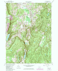
1964 Map of Durham
USGS Topo · Published 1984About this map
Durham and Durham Center serve as the primary hubs in this central Connecticut landscape, situated where the Coginchaug River and Allyn Bk drain northward through the valley. The map reveals a post-war rural community maintaining its educational infrastructure with the Korn Sch and Brewster Sch, while the rugged southern terrain around Bluff Head and Broomstick Ledges remains largely undeveloped forest and watershed.
Find a feature on this map
56 named features on this map. Tap any name to fly to it.
Don’t see what you’re looking for? This feature index may not catch every label — zoom into the map to look around manually.
Map Details
Editions of this 1964 Durham Map
4 editions found
Other maps of this area

1892 · New Haven
USGS Topo · 1:62,500

1892 · Meriden
USGS Topo · 1:62,500

1893 · Guilford
USGS Topo · 1:62,500

1893 · Middletown
USGS Topo · 1:62,500

1893 · Meriden
USGS Topo · 1:62,500

1906 · Farmington
USGS Topo · 1:125,000

1921 · New Haven
USGS Topo · 1:62,500

1928 · Cromwell
USGS Topo · 1:24,000

1943 · Durham
USGS Topo · 1:25,000

1945 · Middle Haddam
USGS Topo · 1:31,680