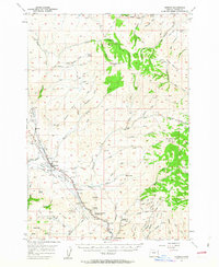
1957 Map of Durkee
USGS Topo · Published 1963About this map
Durkee and Weatherby anchor the transport corridor through this eastern Oregon landscape, where the Union Pacific Railroad and the Old Oregon Trail Highway parallel Durkee Creek and the Burnt River. The map reveals a working terrain of the late 1950s, defined by its mining and ranching history. Local infrastructure is well-represented, from the Plano School and Weatherby School to the utility network marked by a Pipeline, Substation, and Gaging Station.
Find a feature on this map
70 named features on this map. Tap any name to fly to it.
Don’t see what you’re looking for? This feature index may not catch every label — zoom into the map to look around manually.
Map Details
Editions of this 1957 Durkee Map
2 editions found
Other maps of this area

1901 · Baker City
USGS Topo · 1:125,000

1915 · Pine
USGS Topo · 1:125,000

1951 · Huntington
USGS Topo · 1:62,500

1952 · Olds Ferry NW
USGS Topo · 1:24,000

1952 · Olds Ferry
USGS Topo · 1:62,500

1955 · Baker
USGS Topo · 1:250,000

1957 · Halfway
USGS Topo · 1:62,500

1957 · Sparta
USGS Topo · 1:62,500

1957 · Durkee
USGS Topo · 1:62,500

1957 · Mineral
USGS Topo · 1:62,500