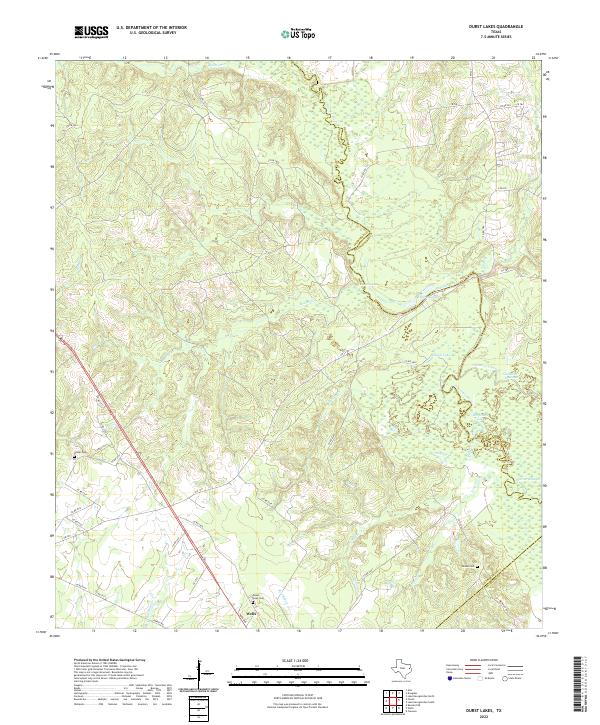
2022 Map of Durst Lakes
USGS Topo · Published 2022About this map
The Angelina River carves a serpentine boundary through East Texas, defining the meeting point of Cherokee, Nacogdoches, and Angelina Counties. This landscape is a complex network of bottomlands and backwaters, featuring numerous oxbows and secondary water bodies such as Horseshoe Lake, Eagle Lake, and the braided paths of the Old River Channel. The low-lying terrain is further saturated by Warner Slough and several smaller tributaries like Beans Cr and Red Bayou.
Find a feature on this map
49 named features on this map. Tap any name to fly to it.
Don’t see what you’re looking for? This feature index may not catch every label — zoom into the map to look around manually.
Map Details
Editions of this 2022 Durst Lakes Map
This is the sole edition of this map. No revisions or reprints were ever made.
Other maps of this area

1946 · Alto
USGS Topo · 1:62,500

1949 · Clawson
USGS Topo · 1:24,000

1950 · Clawson
USGS Topo · 1:24,000

1950 · Kennard NE
USGS Topo · 1:24,000

1951 · Wells
USGS Topo · 1:24,000

1951 · Kennard NE
USGS Topo · 1:24,000

1952 · Douglass
USGS Topo · 1:62,500

1953 · Palestine
USGS Topo · 1:250,000

1957 · Palestine
USGS Topo · 1:250,000
1973 · Forest
USGS Topo · 1:24,000