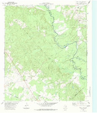
1983 Map of Durst Lakes
USGS Topo · Published 1983About this map
The Angelina River carves a winding path through this East Texas landscape, serving as the border between Nacogdoches and Cherokee Counties. The river's active hydrologic history is visible through features like Durst Lakes, Eagle Lake, and Horseshoe Lake, which populate the alluvial valley alongside the Old River Channel. In the southwestern corner, the town of Wells and the community of Cross Roads serve as local hubs near the St Louis Southwestern railroad line.
Find a feature on this map
34 named features on this map. Tap any name to fly to it.
Don’t see what you’re looking for? This feature index may not catch every label — zoom into the map to look around manually.
Map Details
Editions of this 1983 Durst Lakes Map
This is the sole edition of this map. No revisions or reprints were ever made.
Other maps of this area

1946 · Alto
USGS Topo · 1:62,500

1949 · Clawson
USGS Topo · 1:24,000

1950 · Clawson
USGS Topo · 1:24,000

1950 · Kennard NE
USGS Topo · 1:24,000

1951 · Wells
USGS Topo · 1:24,000

1951 · Kennard NE
USGS Topo · 1:24,000

1952 · Douglass
USGS Topo · 1:62,500

1953 · Palestine
USGS Topo · 1:250,000

1957 · Palestine
USGS Topo · 1:250,000
1973 · Forest
USGS Topo · 1:24,000