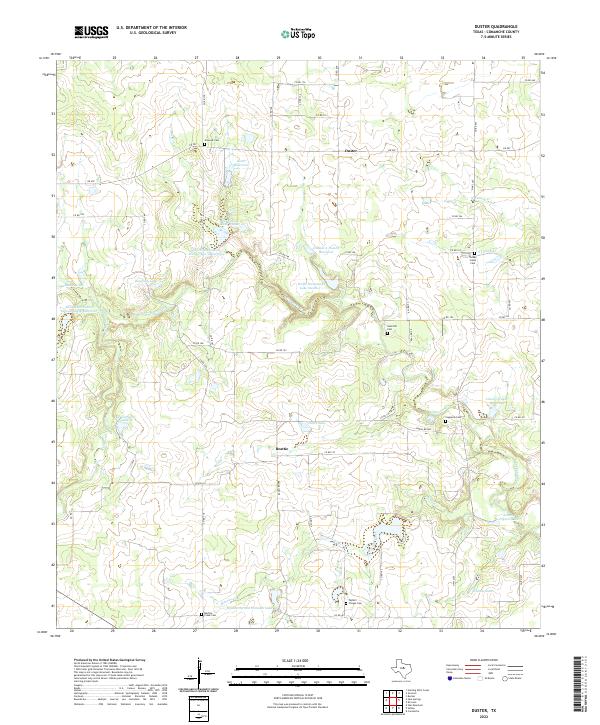
2022 Map of Duster
USGS Topo · Published 2022About this map
Beattie and Duster anchor this Comanche County landscape, defined by a network of ranch roads and small-scale water management. The terrain is crisscrossed by several prominent waterways, including Copperas Cr and Martins Cr, which feed into numerous reservoirs such as Keith Reservoir and Welch Lake. This 2022 survey reveals a landscape deeply rooted in its local heritage, evidenced by a high density of rural cemeteries serving the scattered communities. Family and location-named sites like Turkey Creek Cem, Sand Hill Cem, and Martins Creek Cem are distributed across the quadrangle, often situated near the intersections of local connectors like FM 587 and Ranch Rd 588. The prevalence of soil conservation sites, including Soil Conservation Service Site 4 Reservoir, illustrates the modern emphasis on water retention in this agrarian region of North Central Texas.
Find a feature on this map
63 named features on this map. Tap any name to fly to it.
Don’t see what you’re looking for? This feature index may not catch every label — zoom into the map to look around manually.
Map Details
Editions of this 2022 Duster Map
This is the sole edition of this map. No revisions or reprints were ever made.
Other maps of this area

1889 · Brownwood
USGS Topo · 1:125,000

1894 · Eastland
USGS Topo · 1:125,000

1894 · Brownwood
USGS Topo · 1:125,000

1954 · Brownwood
USGS Topo · 1:250,000

1954 · Abilene
USGS Topo · 1:250,000

1958 · Abilene
USGS Topo · 1:250,000

1966 · Star Mountain
USGS Topo · 1:24,000

1966 · Sipe Springs
USGS Topo · 1:24,000
1968 · Rucker
USGS Topo · 1:24,000
1968 · Gorman
USGS Topo · 1:24,000