Loading...
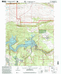
Loading map...1996 Map of Dutch John
USGS Topo · Published 1999About this map
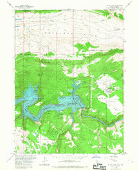
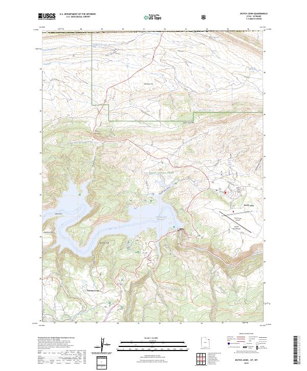
Flaming Gorge Dam dominates this landscape, anchoring a complex of infrastructure including a powerplant, substation, and gaging station along the Green River. The town of Dutch John serves as the primary hub for the Flaming Gorge National Recreation Area, supported by facilities such as the Dutch John Airport and the Flaming Gorge Ranger Station and Nat Rec Area Headquarters.
Find a feature on this map
63 named features on this map. Tap any name to fly to it.
Don’t see what you’re looking for? This feature index may not catch every label — zoom into the map to look around manually.
Map Details
Date Portrayed1996
Date Published1999
PublisherU.S. Geological Survey
Map TypeTopographic
Scale1:24,000
Physical Dimensions21.9 x 26.7 inches
Editions of this 1996 Dutch John Map
This is the sole edition of this map. No revisions or reprints were ever made.
Historical Maps of Flaming Gorge Summer Home Area Through Time
8 maps found
Featured Locations
- United States
- Daggett County, UT
- Sweetwater County, WY
- Dutch John, UT
- Flaming Gorge Summer Home Area, UT
Source Details
SourceU.S. Geological Survey
CopyrightPublic Domain