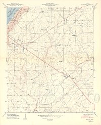
1950 Map of Dutton
USGS Topo · Published 1950About this map
Sand Mountain dominates this portion of the plateau in Northeast Alabama, where the 1950 topography reveals a landscape transition between the Tennessee River valley and the upland agricultural communities. The completion of the Guntersville Reservoir is clearly visible in the northwest corner, creating a shoreline near the Lake Shore Drive Cabin Site Area. Settlement patterns center on crossroads and gap points such as Section, Dutton, and Duncan Crossroads, with the ridge-top terrain characterized by numerous small churches and schools that served the rural population. Local landmarks like Rock City, Gossett Gap, and the Bluff Cem help define the local geography, while the Jackson De Kalb boundary line cuts through the southern reaches of the plateau. This record captures the area after the Tennessee Valley Authority transformations but before the extensive modernization of the late 20th century.
Find a feature on this map
56 named features on this map. Tap any name to fly to it.
Don’t see what you’re looking for? This feature index may not catch every label — zoom into the map to look around manually.
Map Details
Editions of this 1950 Dutton Map
2 editions found
Other maps of this area

1885 · Gadsden
USGS Topo · 1:125,000

1886 · Stevenson
USGS Topo · 1:125,000

1888 · Gadsden
USGS Topo · 1:125,000

1888 · Scottsboro
USGS Topo · 1:125,000

1892 · Scottsboro
USGS Topo · 1:125,000

1892 · Stevenson
USGS Topo · 1:125,000

1892 · Gadsden
USGS Topo · 1:125,000

1893 · Fort Payne
USGS Topo · 1:125,000

1895 · Stevenson
USGS Topo · 1:125,000

1895 · Gadsden
USGS Topo · 1:125,000