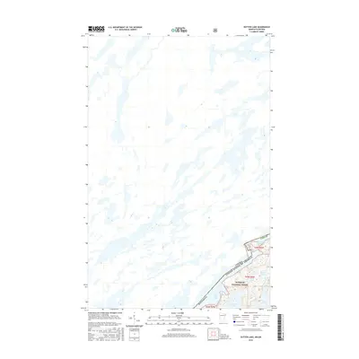
2016 Map of Dutton Lake
USGS Topo · Published 2016About this map
The international boundary between Canada and the United States defines this wilderness landscape, bisecting a network of interconnected glacial lakes. Within the Superior National Forest, the terrain is dominated by water bodies such as Ottertrack Lake and Knife Lake, which have served as traditional travel corridors through the Boundary Waters region. This 2016 survey captures the intricate shoreline of Dutton Lake and Conic Lake along the southern edge of the border, providing a high-resolution view of the remote topography of Minnesota's northern reaches. The map reflects a landscape managed for conservation, where the absence of roads and modern infrastructure highlights a commitment to preserving the historic portage routes and pristine hydrology of the Rainy River District.
Find a feature on this map
13 named features on this map. Tap any name to fly to it.
Don’t see what you’re looking for? This feature index may not catch every label — zoom into the map to look around manually.
Map Details
Editions of this 2016 Dutton Lake Map
This is the sole edition of this map. No revisions or reprints were ever made.
Other maps of this area

1957 · Ensign Lake
USGS Topo · 1:62,500

1957 · Quetico
USGS Topo · 1:250,000

1959 · Ogishkemuncie Lake
USGS Topo · 1:24,000

1959 · Kekekabic Lake
USGS Topo · 1:24,000

1959 · Dutton Lake
USGS Topo · 1:24,000

1959 · Ester Lake
USGS Topo · 1:24,000

1968 · Quetico
USGS Topo · 1:250,000
1976 · Ensign Lake SE
USGS Topo · 1:24,000

1977 · Basswood Lake
USGS Topo · 1:100,000
1981 · Ensign Lake East
USGS Topo · 1:24,000