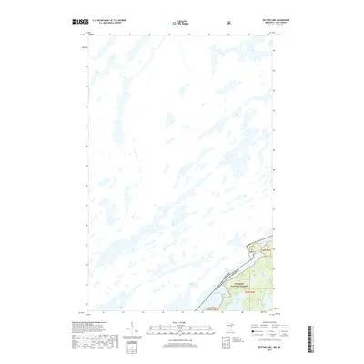
2019 Map of Dutton Lake
USGS Topo · Published 2019About this map
The international boundary between the United States and Canada cuts through this portion of the Superior National Forest in Lake County, Minnesota. The landscape is dominated by the glacial interconnectedness of the Boundary Waters, where long, narrow bodies of water like Knife Lake and Ottertrack Lake follow the northeast-southwest geological grain of the Canadian Shield. This 2019 survey documents the intricate water network within the Rainy River District, including smaller interior basins such as Dutton Lake, Amoeber Lake, and Conic Lake. The map illustrates the preservation of a primitive wilderness character, showing no roads or established settlements, focusing instead on the hydrography and elevation contours that define this protected forest region.
Find a feature on this map
10 named features on this map. Tap any name to fly to it.
Don’t see what you’re looking for? This feature index may not catch every label — zoom into the map to look around manually.
Map Details
Editions of this 2019 Dutton Lake Map
This is the sole edition of this map. No revisions or reprints were ever made.
Other maps of this area

1957 · Ensign Lake
USGS Topo · 1:62,500

1957 · Quetico
USGS Topo · 1:250,000

1959 · Ogishkemuncie Lake
USGS Topo · 1:24,000

1959 · Kekekabic Lake
USGS Topo · 1:24,000

1959 · Dutton Lake
USGS Topo · 1:24,000

1959 · Ester Lake
USGS Topo · 1:24,000

1968 · Quetico
USGS Topo · 1:250,000
1976 · Ensign Lake SE
USGS Topo · 1:24,000

1977 · Basswood Lake
USGS Topo · 1:100,000
1981 · Ensign Lake East
USGS Topo · 1:24,000