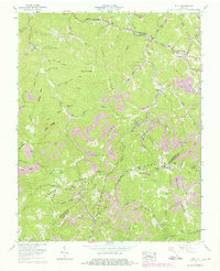
1958 Map of Duty
USGS Topo · Published 1976About this map
Long Ridge and Sandy Ridge dominate the landscape of this southwestern Virginia quadrangle, where the borders of Buchanan, Dickenson, and Russell Counties meet. In the late 1950s, the region's economy is clearly defined by coal extraction and timber, most notably at the Moss No 3 Mine and various Strip mine sites. This industrial presence contrasts with the numerous family cemeteries and small rural institutions that dot the hollows, such as the Sutherland Cemetery and Sullivan Branch School. Settlements like Tiny, Bee, and Davenport are tucked along the winding waterways of Fryingpan Creek and Indian Creek. The map records a complex network of ridgeline gaps, including Abner Gap and Spruce Pine Gap, which historically dictated the movement of people and resources before the expansion of modern infrastructure like the industrial Conveyor system shown near the mine.
Find a feature on this map
104 named features on this map. Tap any name to fly to it.
Don’t see what you’re looking for? This feature index may not catch every label — zoom into the map to look around manually.
Map Details
Editions of this 1958 Duty Map
Other maps of this area

1886 · Grundy
USGS Topo · 1:125,000

1890 · Grundy
USGS Topo · 1:125,000

1892 · Grundy
USGS Topo · 1:125,000

1897 · Bristol
USGS Topo · 1:125,000

1902 · Bristol
USGS Topo · 1:125,000

1913 · Clintwood
USGS Topo · 1:62,500

1914 · Bucu
USGS Topo · 1:48,000

1915 · Clintwood
USGS Topo · 1:62,500

1916 · Bucu
USGS Topo · 1:62,500

1918 · Carterton
USGS Topo · 1:62,500