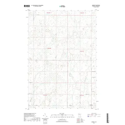
2019 Map of Duxbury
USGS Topo · Published 2019About this map
Duxbury anchors the southeast corner of this northern Minnesota landscape, where the Lower Tamarack River winds through a complex network of wetlands and seasonal watercourses. The area's history of timber harvesting is reflected in the naming of local routes such as Fleming Logging Rd and Logger's Ln, which traverse the low-lying terrain. The hydrography is particularly dense, defined by the converging forks of Crooked Creek, including the W Fork Crooked Cr, Middle Crooked Cr, and E Fork Crooked Cr. Near the intersection of Duxbury Rd and Friesendahl Rd, the Danforth Cem provides a focal point for genealogical research. Further north, the landscape remains largely undeveloped, characterized by numerous small lakes and creeks like Strawberry Cr and Thunder Cr that drain into the larger river systems of Pine County.
Find a feature on this map
31 named features on this map. Tap any name to fly to it.
Don’t see what you’re looking for? This feature index may not catch every label — zoom into the map to look around manually.
Map Details
Editions of this 2019 Duxbury Map
This is the sole edition of this map. No revisions or reprints were ever made.
Other maps of this area

1949 · Danbury
USGS Topo · 1:48,000

1949 · Holyoke
USGS Topo · 1:48,000

1953 · Duluth
USGS Topo · 1:250,000

1958 · Duluth
USGS Topo · 1:250,000

1962 · Holyoke
USGS Topo · 1:62,500

1962 · Bruno
USGS Topo · 1:62,500

1962 · Cloverdale
USGS Topo · 1:62,500

1962 · Danbury
USGS Topo · 1:62,500

1980 · Sandstone
USGS Topo · 1:100,000
1981 · Cloverdale
USGS Topo · 1:24,000