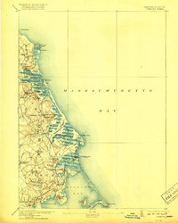
1893 Map of Duxbury
USGS Topo · Published 1918About this map
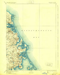
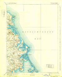
Scituate Harbor and the long, protective sweep of Duxbury Beach anchor this coastal survey, which documents the shoreline of Plymouth County in the late nineteenth century. A significant maritime and communication hub, the area features a Telegraph Cable to Brest terminating at the Cable House, linking this stretch of Massachusetts directly to Europe. The landscape is defined by the intricate waterways of the North River and South River, where tidal marshes like Green Harbor Marsh and Duxbury Marsh meet established settlements. Rail infrastructure is well-developed, with stops at Marshfield Station, Green Harbor Station, and South Duxbury Station facilitating movement through the seaside towns. Historical landmarks, including the Standish Monument on Captains Hill and the Gurnet Lights at the mouth of Plymouth Bay, serve as vital navigational aids for the region's busy seafaring economy.
Find a feature on this map
70 named features on this map. Tap any name to fly to it.
Don’t see what you’re looking for? This feature index may not catch every label — zoom into the map to look around manually.
Map Details
Editions of this 1893 Duxbury Map
7 editions found

Other maps of this area

1885 · Abington
USGS Topo · 1:62,500

1885 · Duxbury
USGS Topo · 1:62,500

1885 · Middleboro
USGS Topo · 1:62,500

1886 · Plymouth
USGS Topo · 1:62,500

1888 · Duxbury
USGS Topo · 1:62,500

1888 · Middleboro
USGS Topo · 1:62,500

1888 · Abington
USGS Topo · 1:62,500

1889 · Plymouth
USGS Topo · 1:62,500

1892 · Boston Bay
USGS Topo · 1:62,500

1893 · Abington
USGS Topo · 1:62,500