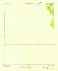
1959 Map of Dyer Gap
USGS Topo · Published 1959About this map
Cherokee National Forest territory along the high ridges of North Georgia is documented in this survey, showing the mountain passes and peaks before modern development. The map follows a primary Ridge line that serves as a natural barrier and a point of orientation, marked by a series of high-altitude crossings including Dyer Gap, Newt Gap, and Halloway Gap. A notable landmark of the era is the Flat Top Fire Tower, situated on a peak near the boundary between Fannin Co and Gilmer Co. This advance sheet, based on field examinations from the mid-1930s, focuses on the high-elevation terrain where the headwaters of Postelle Creek begin their descent. It is a specialized record of forestry and fire prevention infrastructure in the Appalachian highlands.
Find a feature on this map
8 named features on this map. Tap any name to fly to it.
Don’t see what you’re looking for? This feature index may not catch every label — zoom into the map to look around manually.
Map Details
Editions of this 1959 Dyer Gap Map
3 editions found
Other maps of this area

1886 · Dalton
USGS Topo · 1:125,000

1888 · Ellijay
USGS Topo · 1:125,000

1892 · Ellijay
USGS Topo · 1:125,000

1892 · Dalton
USGS Topo · 1:125,000

1897 · Dalton
USGS Topo · 1:125,000

1898 · Ellijay
USGS Topo · 1:125,000

1911 · Ellijay
USGS Topo · 1:125,000

1911 · Cohutta Mtn
USGS Topo · 1:62,500

1913 · Cohutta Mtn.
USGS Topo · 1:62,500

1914 · Talking Rock
USGS Topo · 1:62,500