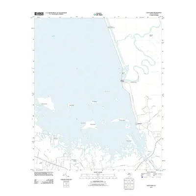
2011 Map of Eadytown
USGS Topo · Published 2011About this map
Lake Marion dominates this South Carolina landscape, its waters broken by a series of islands including Sixteen Island, Bass Island, and Church Island. The shoreline is marked by the presence of the Santee Dam and the South Carolina Noname 14016 Dam, which manage the hydrological relationship between the lake and the Santee River. Along the eastern bank, settlements such as Eadytown and Wilsons Landing serve as local hubs, connected by a network of rural roads like Wilson Landing Rd.
Find a feature on this map
53 named features on this map. Tap any name to fly to it.
Don’t see what you’re looking for? This feature index may not catch every label — zoom into the map to look around manually.
Map Details
Editions of this 2011 Eadytown Map
This is the sole edition of this map. No revisions or reprints were ever made.
Other maps of this area

1920 · Eutawville
USGS Topo · 1:48,000

1920 · Chicora
USGS Topo · 1:48,000

1920 · Manning
USGS Topo · 1:48,000

1921 · Chicora
USGS Topo · 1:62,500

1921 · Manning
USGS Topo · 1:62,500

1921 · Eutawville
USGS Topo · 1:62,500

1943 · Chicora
USGS Topo · 1:62,500

1943 · Eutawville
USGS Topo · 1:62,500

1944 · Manning
USGS Topo · 1:62,500

1954 · Augusta
USGS Topo · 1:250,000