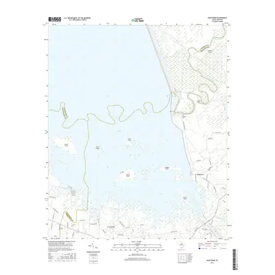
2017 Map of Eadytown
USGS Topo · Published 2017About this map
Lake Marion dominates this South Carolina landscape, where the waters of the Santee River and Little River meet at the borders of Berkeley, Clarendon, and Orangeburg Counties. The map documents a complex archipelago of named landforms within the lake, including Church Island, Pine Island, and Bass Island. Along the eastern shore, the settlement of Eadytown serves as a focal point for local infrastructure, situated near the historic path of the Santee Canal.
Find a feature on this map
55 named features on this map. Tap any name to fly to it.
Don’t see what you’re looking for? This feature index may not catch every label — zoom into the map to look around manually.
Map Details
Editions of this 2017 Eadytown Map
This is the sole edition of this map. No revisions or reprints were ever made.
Other maps of this area

1920 · Eutawville
USGS Topo · 1:48,000

1920 · Chicora
USGS Topo · 1:48,000

1920 · Manning
USGS Topo · 1:48,000

1921 · Chicora
USGS Topo · 1:62,500

1921 · Manning
USGS Topo · 1:62,500

1921 · Eutawville
USGS Topo · 1:62,500

1943 · Chicora
USGS Topo · 1:62,500

1943 · Eutawville
USGS Topo · 1:62,500

1944 · Manning
USGS Topo · 1:62,500

1954 · Augusta
USGS Topo · 1:250,000