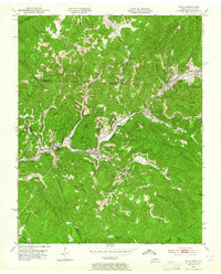
1953 Map of Eagan
USGS Topo · Published 1964About this map
The mountain settlements of Eagan and Clairfield sit deep within the Appalachian coalfields at the border of Tennessee and Kentucky. This early 1950s terrain reveals a landscape heavily shaped by the extractive economy, where numerous Strip Mines and a Tipple are connected by the Southern railroad and a specialized Tramway. The industrial presence is woven into the community fabric, evidenced by the proximity of Buffalo School and Claiborne School to the working slopes of Miller Mountain and King Mountain.
Find a feature on this map
57 named features on this map. Tap any name to fly to it.
Don’t see what you’re looking for? This feature index may not catch every label — zoom into the map to look around manually.
Map Details
Editions of this 1953 Eagan Map
3 editions found
Other maps of this area

1886 · Cumberland Gap
USGS Topo · 1:125,000

1888 · Cumberland Gap
USGS Topo · 1:125,000

1890 · Williamsburg
USGS Topo · 1:125,000

1891 · Cumberland Gap
USGS Topo · 1:125,000

1893 · Briceville
USGS Topo · 1:125,000

1894 · Williamsburg
USGS Topo · 1:125,000

1895 · Briceville
USGS Topo · 1:125,000

1896 · Briceville
USGS Topo · 1:125,000

1897 · Maynardville
USGS Topo · 1:125,000

1900 · Maynardville
USGS Topo · 1:125,000