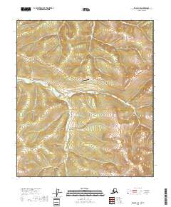
2018 Map of Eagle A-1 SE
USGS Topo · Published 2018About this map
The Top of the World Highway winds through this high-latitude terrain within the Southeast Fairbanks Census Area, serving as a critical artery near the international border. This remote landscape is defined by a dense network of watercourses, including the westward-flowing Walker Fork and its many tributaries such as Cherry Cr, Turk Cr, and Carline Cr. The presence of the Boundary Airport near the center of the sheet highlights the region's reliance on aviation for connectivity in an area where roads are sparse.
Find a feature on this map
24 named features on this map. Tap any name to fly to it.
Don’t see what you’re looking for? This feature index may not catch every label — zoom into the map to look around manually.
Map Details
Editions of this 2018 Eagle A-1 SE Map
This is the sole edition of this map. No revisions or reprints were ever made.
Other maps of this area

1899 · Fortymile
USGS Topo · 1:250,000

1949 · Tanacross
USGS Topo · 1:250,000

1950 · Tanacross
USGS Topo · 1:250,000

1951 · Eagle
USGS Topo · 1:250,000

1956 · Tanacross D-1
USGS Topo · 1:63,360

1956 · Eagle A-1
USGS Topo · 1:63,360

1956 · Tanacross
USGS Topo · 1:250,000

1957 · Eagle
USGS Topo · 1:250,000

1964 · Tanacross
USGS Topo · 1:250,000
2013 · Tanacross D-1 NE
USGS Topo · 1:25,000