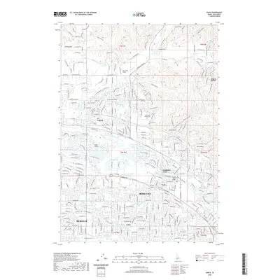
2020 Map of Eagle
USGS Topo · Published 2020About this map
Eagle and the surrounding Treasure Valley communities of Garden City and Boise City are defined by an intricate network of irrigation and water management features. The Boise River splits to encompass Eagle Island, while the Boise River Greenbelt follows its course through the urbanizing landscape. This 2020 record illustrates the complex plumbing of the valley, showing historic watercourses like the Farmers Union Canal, Thurman Mill Canal, and the Settlers Canal as they weave through residential developments. To the north, the terrain transitions into the foothills around Dry Creek Valley and Hidden Springs. Notable landmarks include the Idaho State Veterans Cem and the campus of Boise Bible College, providing clear reference points for local history and genealogy research in Ada County.
Find a feature on this map
135 named features on this map. Tap any name to fly to it.
Don’t see what you’re looking for? This feature index may not catch every label — zoom into the map to look around manually.
Map Details
Editions of this 2020 Eagle Map
This is the sole edition of this map. No revisions or reprints were ever made.
Other maps of this area

1892 · Boise
USGS Topo · 1:125,000

1897 · Boise
USGS Topo · 1:125,000

1953 · Eagle
USGS Topo · 1:24,000

1953 · Cloverdale
USGS Topo · 1:24,000

1953 · Meridian
USGS Topo · 1:24,000

1953 · Star
USGS Topo · 1:24,000

1953 · Montour
USGS Topo · 1:62,500

1954 · Boise South
USGS Topo · 1:24,000

1954 · Boise North
USGS Topo · 1:24,000

1954 · Boise
USGS Topo · 1:62,500