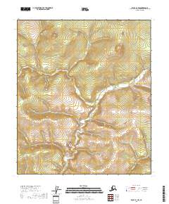
2018 Map of Eagle B-1 NW
USGS Topo · Published 2018About this map
The watershed of O'Brien Cr dominates this 2018 survey of the interior landscape in the Southeast Fairbanks region. Flowing through a series of steep drainages, the stream network includes Columbia Cr and McKinley Cr, illustrating the complex hydrological patterns typical of this subarctic terrain. The map captures a moment of modern land management, clearly delineating the Public Land Survey System grid with sections of t5s r32e and t6s r32e noted. Though remote, the area is defined by these named watercourses, including King Cr and Little Johnny Cr, which likely served as primary reference points for early prospectors or surveyors. The lack of established road infrastructure on this quadrangle, save for a single route marked as 5, underscores the isolation of these interior Alaskan valleys and their continued reliance on the natural corridors formed by their waterways.
Find a feature on this map
15 named features on this map. Tap any name to fly to it.
Don’t see what you’re looking for? This feature index may not catch every label — zoom into the map to look around manually.
Map Details
Editions of this 2018 Eagle B-1 NW Map
This is the sole edition of this map. No revisions or reprints were ever made.
Other maps of this area

1899 · Fortymile
USGS Topo · 1:250,000

1951 · Eagle
USGS Topo · 1:250,000

1956 · Eagle C-1
USGS Topo · 1:63,360

1956 · Eagle C-2
USGS Topo · 1:63,360

1956 · Eagle B-2
USGS Topo · 1:63,360

1956 · Eagle B-1
USGS Topo · 1:63,360

1957 · Eagle
USGS Topo · 1:250,000
2018 · Eagle B-1 SE
USGS Topo · 1:25,000
2018 · Eagle B-2 SE
USGS Topo · 1:25,000
2018 · Eagle C-2 SE
USGS Topo · 1:25,000