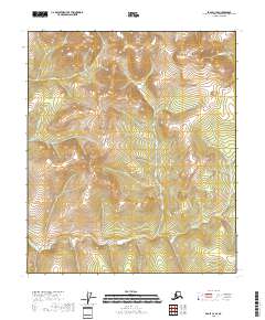
2018 Map of Eagle C-2 SE
USGS Topo · Published 2018About this map
The Mertie Mountains dominate the western edge of this interior Alaska landscape, providing a high-relief backdrop to a complex network of northern drainages. Within the Southeast Fairbanks Census Area, the terrain is defined by the headwaters of several remote waterways, including the winding course of Bear Cr and the extensive basin of Champion Cr. The drainage pattern suggests a high-elevation plateau deeply dissected by water action, with smaller tributaries like Oregon Cr and Teddys Fork branching into narrow valleys. This 2018 survey reveals the raw hydrography of the subarctic wilderness before these waters reach the larger regional river systems. The southeastern portion of the map is particularly intricate, where the Little Champion Cr begins its descent through the steepening slopes of the mountain range.
Find a feature on this map
12 named features on this map. Tap any name to fly to it.
Don’t see what you’re looking for? This feature index may not catch every label — zoom into the map to look around manually.
Map Details
Editions of this 2018 Eagle C-2 SE Map
This is the sole edition of this map. No revisions or reprints were ever made.
Other maps of this area

1899 · Fortymile
USGS Topo · 1:250,000

1951 · Eagle
USGS Topo · 1:250,000

1956 · Eagle C-1
USGS Topo · 1:63,360

1956 · Eagle C-2
USGS Topo · 1:63,360

1956 · Eagle B-2
USGS Topo · 1:63,360

1956 · Eagle B-1
USGS Topo · 1:63,360

1957 · Eagle
USGS Topo · 1:250,000
2018 · Eagle B-2 NW
USGS Topo · 1:25,000
2018 · Eagle B-1 NW
USGS Topo · 1:25,000
2018 · Eagle C-2 NE
USGS Topo · 1:25,000