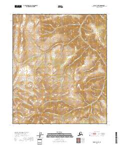
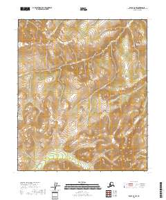
2018 Map of Eagle C-2 NE
USGS Topo · Published 2018About this map
Wallcutt Mtn stands as the primary landmark in this interior Alaskan landscape within the Southeast Fairbanks region. The area is defined by a dense network of high-elevation drainages that feed into the larger Mission Cr system. To the north, Utah Cr and Cripple Cr cut through the steep topography, while Clifford Cr and Black-Diamond Cr mark the central valleys. The absence of roads or established settlements reflects the isolation of this terrain in the early 21st century. Instead, the map reveals a purely hydrologic and topographic character, tracing the paths of Dominion Cr and Oregon Cr as they navigate the complex ridgelines. For those researching the geography of the Fairbanks Census Area, these specific named creeks provide essential points of reference for navigating the unpopulated reaches of the eastern interior.
Find a feature on this map
14 named features on this map. Tap any name to fly to it.
Don’t see what you’re looking for? This feature index may not catch every label — zoom into the map to look around manually.
Map Details
Editions of this 2018 Eagle C-2 NE Map
This is the sole edition of this map. No revisions or reprints were ever made.
Other maps of this area

1899 · Fortymile
USGS Topo · 1:250,000

1951 · Eagle
USGS Topo · 1:250,000

1956 · Eagle C-1
USGS Topo · 1:63,360

1956 · Eagle D-2
USGS Topo · 1:63,360

1956 · Eagle C-2
USGS Topo · 1:63,360
1956 · Eagle D-1
USGS Topo · 1:63,360

1957 · Eagle
USGS Topo · 1:250,000
2018 · Eagle D-2 SE
USGS Topo · 1:25,000
2018 · Eagle C-2 SE
USGS Topo · 1:25,000
2018 · Eagle D-2 SW
USGS Topo · 1:25,000