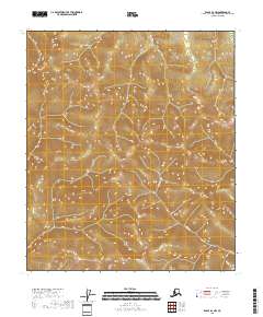
2018 Map of Eagle B-2 NW
USGS Topo · Published 2018About this map
Alder Creek flows through the southern reaches of this interior Alaskan wilderness within the Southeast Fairbanks Census Area. The terrain is defined by a dense network of high ridges and deep valleys, captured through precise contour lines that reveal the complex drainage patterns of the subarctic landscape. Beyond the watercourse of Alder Creek, the map focuses on the official land partitions of the Public Land Survey System, specifically detailing the junctions of t5s r29e, t5s r30e, t6s r29e, and t6s r30e. This survey emphasizes the raw topography and township boundaries of a region largely untouched by modern development or permanent infrastructure.
Find a feature on this map
5 named features on this map. Tap any name to fly to it.
Don’t see what you’re looking for? This feature index may not catch every label — zoom into the map to look around manually.
Map Details
Editions of this 2018 Eagle B-2 NW Map
This is the sole edition of this map. No revisions or reprints were ever made.
Other maps of this area

1899 · Fortymile
USGS Topo · 1:250,000

1951 · Eagle
USGS Topo · 1:250,000

1956 · Eagle C-2
USGS Topo · 1:63,360

1956 · Eagle B-2
USGS Topo · 1:63,360

1956 · Eagle B-3
USGS Topo · 1:63,360

1956 · Eagle C-3
USGS Topo · 1:63,360

1957 · Eagle
USGS Topo · 1:250,000
2018 · Eagle C-3 SE
USGS Topo · 1:25,000
2018 · Eagle B-3 SE
USGS Topo · 1:25,000
2018 · Eagle B-2 SE
USGS Topo · 1:25,000