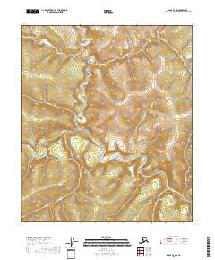
2018 Map of Eagle B-1 SW
USGS Topo · Published 2018About this map
The Fortymile River carves a winding path through the heart of the Southeast Fairbanks Census Area, serving as the central drainage for a dense network of creek systems. This modern U.S. Geological Survey topographic study documents the complex hydrology of the region, where numerous named tributaries such as O'Brien Cr and Polly Cr descend from the high ridges. The lack of roads or established settlements on this sheet highlights the wilderness character of the interior, defined by the township and range lines of the Public Land Survey System. Researchers can trace the narrow valleys of Dick Dale Cr and Steele Cr as they feed into the main river channel, illustrating the undisturbed drainage patterns of this Alaskan landscape.
Find a feature on this map
20 named features on this map. Tap any name to fly to it.
Don’t see what you’re looking for? This feature index may not catch every label — zoom into the map to look around manually.
Map Details
Editions of this 2018 Eagle B-1 SW Map
This is the sole edition of this map. No revisions or reprints were ever made.
Other maps of this area

1899 · Fortymile
USGS Topo · 1:250,000

1951 · Eagle
USGS Topo · 1:250,000

1956 · Eagle A-1
USGS Topo · 1:63,360

1956 · Eagle B-2
USGS Topo · 1:63,360

1956 · Eagle A-2
USGS Topo · 1:63,360

1956 · Eagle B-1
USGS Topo · 1:63,360

1957 · Eagle
USGS Topo · 1:250,000
2018 · Eagle A-1 NW
USGS Topo · 1:25,000
2018 · Eagle B-1 SE
USGS Topo · 1:25,000
2018 · Eagle B-2 SE
USGS Topo · 1:25,000