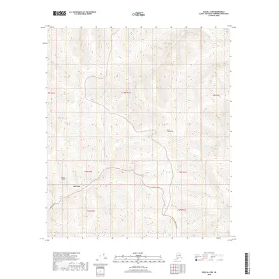
2018 Map of Eagle A-1 NW
USGS Topo · Published 2018About this map
Jack Wade sits at the junction of several drainage systems in the Fortymile region of Alaska, serving as a primary point of reference in this interior landscape. The area is defined by its complex network of gold-bearing creeks, including Wade Cr, Gilliland Cr, and Austin Cr. The terrain is dominated by prominent landforms such as Steele Creek Dome and the deep incision of Fifteen Gulch.
Find a feature on this map
29 named features on this map. Tap any name to fly to it.
Don’t see what you’re looking for? This feature index may not catch every label — zoom into the map to look around manually.
Map Details
Editions of this 2018 Eagle A-1 NW Map
This is the sole edition of this map. No revisions or reprints were ever made.
Other maps of this area

1899 · Fortymile
USGS Topo · 1:250,000

1951 · Eagle
USGS Topo · 1:250,000

1956 · Eagle A-1
USGS Topo · 1:63,360

1956 · Eagle B-2
USGS Topo · 1:63,360

1956 · Eagle A-2
USGS Topo · 1:63,360

1956 · Eagle B-1
USGS Topo · 1:63,360

1957 · Eagle
USGS Topo · 1:250,000
2018 · Eagle A-2 SE
USGS Topo · 1:25,000
2018 · Eagle B-1 SE
USGS Topo · 1:25,000
2018 · Eagle B-2 SE
USGS Topo · 1:25,000