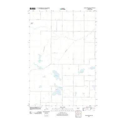
2010 Map of Eagle Bend NW
USGS Topo · Published 2010About this map
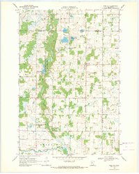
The Wing River winds through the northern portion of this Otter Tail County landscape, where the land is defined by an intricate network of glacial lakes and drainage systems. Cultural history is anchored at the Trefoldighed Menighed Cemetery in the northwest, serving as a significant landmark for genealogical research in this rural township area. The terrain transitions from the river valley to a dense cluster of water bodies in the south, including West Annalaide Lake, East Annalaide Lake, and Lake Mary. This 2010 survey reflects a deeply managed hydrological landscape, evidenced by the presence of Annalaide Lake Ditch and County Ditch Number Thirteen, which connect the natural basins of Rice Lake and the Maple Lakes. The road network follows a strict sectional grid, with Otter Tail Line RD marking a primary boundary and providing access to the scattered homesteads and lakefronts.
Find a feature on this map
42 named features on this map. Tap any name to fly to it.
Don’t see what you’re looking for? This feature index may not catch every label — zoom into the map to look around manually.
Map Details
Editions of this 2010 Eagle Bend NW Map
This is the sole edition of this map. No revisions or reprints were ever made.
Other maps of this area

1953 · Brainerd
USGS Topo · 1:250,000

1957 · Brainerd
USGS Topo · 1:250,000

1958 · Brainerd
USGS Topo · 1:250,000

1965 · Brainerd
USGS Topo · 1:250,000
1969 · Clotho
USGS Topo · 1:24,000
1969 · Lake Miltona East
USGS Topo · 1:24,000
1969 · Eagle Bend
USGS Topo · 1:24,000

1969 · Henning SE
USGS Topo · 1:24,000
1969 · Rose City
USGS Topo · 1:24,000

1969 · Bertha
USGS Topo · 1:24,000