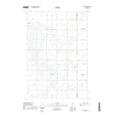
2019 Map of Eagle Bend NW
USGS Topo · Published 2019About this map
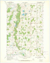
Wing River winds through this section of central Minnesota, defining a landscape marked by glacial lakes and a complex network of agricultural drainage. The border between Otter Tail and Todd counties runs vertically along Otter Tail Line Rd, bisecting a region where water management is central to the land's utility. Significant civil engineering is evident in the County Ditch Number Thirteen and the Annelaide Lake Ditch, which connect various basins to manage the water table for surrounding farms. Local heritage is anchored at the Trefoldighed Menighed Cem and Oak Grove Cem, which serve as quiet landmarks among the expansive wetlands and lakes like North Maple Lake, West Annelaide Lake, and Lake Mary. The map illustrates a contemporary rural infrastructure where county highways and numbered avenues create a precise grid over the naturally irregular hydrography.
Find a feature on this map
60 named features on this map. Tap any name to fly to it.
Don’t see what you’re looking for? This feature index may not catch every label — zoom into the map to look around manually.
Map Details
Editions of this 2019 Eagle Bend NW Map
This is the sole edition of this map. No revisions or reprints were ever made.
Other maps of this area

1953 · Brainerd
USGS Topo · 1:250,000

1957 · Brainerd
USGS Topo · 1:250,000

1958 · Brainerd
USGS Topo · 1:250,000

1965 · Brainerd
USGS Topo · 1:250,000
1969 · Clotho
USGS Topo · 1:24,000
1969 · Lake Miltona East
USGS Topo · 1:24,000
1969 · Eagle Bend
USGS Topo · 1:24,000

1969 · Henning SE
USGS Topo · 1:24,000
1969 · Rose City
USGS Topo · 1:24,000

1969 · Bertha
USGS Topo · 1:24,000