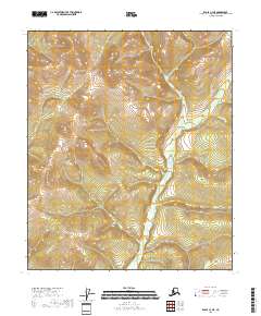
2018 Map of Eagle C-3 NE
USGS Topo · Published 2018About this map
Butte Cr flows through the central and southern reaches of this interior landscape in the Southeast Fairbanks Census Area. The terrain is defined by the steep elevation changes of the Yukon-Tanana Uplands, where the drainage patterns of McMahon Cr carve through high ridges. This 2018 survey illustrates a remote portion of the Alaskan wilderness, primarily used for large-scale land management as indicated by the prominent Public Land Survey System township and range boundaries including t2s r28e and t3s r28e. The lack of roads or structures highlights the isolation of this region near the Canadian border, where the landscape remains dominated by natural waterways and topographic relief.
Find a feature on this map
8 named features on this map. Tap any name to fly to it.
Don’t see what you’re looking for? This feature index may not catch every label — zoom into the map to look around manually.
Map Details
Editions of this 2018 Eagle C-3 NE Map
This is the sole edition of this map. No revisions or reprints were ever made.
Other maps of this area

1899 · Fortymile
USGS Topo · 1:250,000

1951 · Eagle
USGS Topo · 1:250,000

1956 · Eagle D-2
USGS Topo · 1:63,360

1956 · Eagle C-2
USGS Topo · 1:63,360

1956 · Eagle D-3
USGS Topo · 1:63,360

1956 · Eagle C-3
USGS Topo · 1:63,360

1957 · Eagle
USGS Topo · 1:250,000
2018 · Eagle C-3 SE
USGS Topo · 1:25,000
2018 · Eagle C-3 SW
USGS Topo · 1:25,000
2018 · Eagle D-3 SW
USGS Topo · 1:25,000