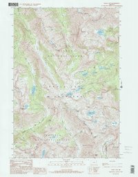
1990 Map of Eagle Cap
USGS Topo · Published 1995About this map
Sacajawea Peak and the Matterhorn dominate this 1990 survey of the high-altitude landscape where the Wallowa National Forest and Whitman National Forest meet. The terrain is defined by dramatic ridgelines including the Hurricane Divide and Hurwal Divide, which separate deep glacial valleys and alpine basins. The central Lake Basin is densely concentrated with water bodies such as Mirror Lake, Moccasin Lake, and Douglas Lake.
Find a feature on this map
52 named features on this map. Tap any name to fly to it.
Don’t see what you’re looking for? This feature index may not catch every label — zoom into the map to look around manually.
Map Details
Editions of this 1990 Eagle Cap Map
3 editions found
Other maps of this area

1954 · Cornucopia
USGS Topo · 1:62,500

1954 · Eagle Cap
USGS Topo · 1:62,500

1955 · Grangeville
USGS Topo · 1:250,000

1957 · Enterprise
USGS Topo · 1:62,500

1957 · Joseph
USGS Topo · 1:62,500

1959 · Grangeville
USGS Topo · 1:250,000

1986 · Enterprise
USGS Topo · 1:100,000
1990 · Krag Peak
USGS Topo · 1:24,000

1990 · Chief Joseph Mtn
USGS Topo · 1:24,000
1990 · Eagle Cap
USGS Topo · 1:24,000