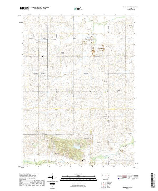
2022 Map of Eagle Center
USGS Topo · Published 2022About this map
The unincorporated community of Eagle Center serves as the focal point for this agrarian landscape in southern Black Hawk County. The township geometry is defined by a grid of county roads such as Kimball Ave and Hawkeye Rd, which cross rolling terrain drained by Miller Cr and Mud Cr. A high concentration of rural burial grounds, including the Saint Mary of Mount Carmel Cem, Eagle Cem, and Spencer Cem, suggests a long-settled community with deep genealogical roots in the surrounding prairie. Near the center of the sheet, the presence of Nichols Airport provides a distinct modern aviation landmark amidst the traditional farmsteads. To the south, the terrain descends toward the valley of Wolf Creek as the map crosses the boundary into Tama County.
Find a feature on this map
59 named features on this map. Tap any name to fly to it.
Don’t see what you’re looking for? This feature index may not catch every label — zoom into the map to look around manually.
Map Details
Editions of this 2022 Eagle Center Map
This is the sole edition of this map. No revisions or reprints were ever made.
Other maps of this area

1954 · Waterloo
USGS Topo · 1:250,000

1955 · Waterloo
USGS Topo · 1:250,000

1963 · Buckingham
USGS Topo · 1:24,000

1963 · Hudson
USGS Topo · 1:24,000

1963 · Waterloo South
USGS Topo · 1:24,000

1963 · Eagle Center
USGS Topo · 1:24,000

1971 · Gilbertville
USGS Topo · 1:24,000
1971 · Dysart
USGS Topo · 1:24,000

1971 · La Porte City
USGS Topo · 1:24,000

1971 · Traer
USGS Topo · 1:24,000