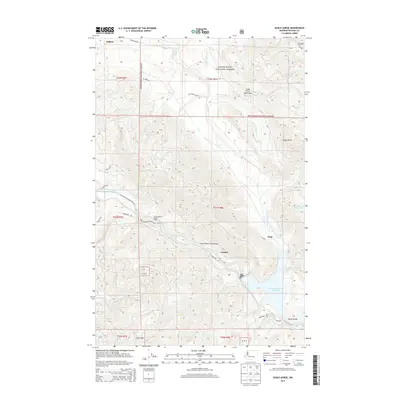
2014 Map of Eagle Gorge
USGS Topo · Published 2014About this map
The Green River carves through the heart of the Snoqualmie National Forest, defining a landscape heavily influenced by regional water management and the timber industry. Small settlements like Selleck, Lemolo, and Eagle Gorge sit along the periphery of a strictly controlled environment, including the Green River Watershed and the Cedar River Watershed. The geography here is dominated by the Howard A Hanson Reservoir and infrastructure such as the Tacoma Water Supply Intake, which underscores the transition of this area from a rugged logging frontier to a vital municipal utility resource.
Find a feature on this map
44 named features on this map. Tap any name to fly to it.
Don’t see what you’re looking for? This feature index may not catch every label — zoom into the map to look around manually.
Map Details
Editions of this 2014 Eagle Gorge Map
This is the sole edition of this map. No revisions or reprints were ever made.
Other maps of this area

1913 · Cedar Lake
USGS Topo · 1:125,000

1953 · North Bend
USGS Topo · 1:24,000

1953 · Hobart
USGS Topo · 1:24,000

1953 · Eagle Gorge
USGS Topo · 1:24,000

1953 · Cumberland
USGS Topo · 1:24,000

1956 · Greenwater
USGS Topo · 1:62,500

1956 · Enumclaw
USGS Topo · 1:62,500
1956 · Enumclaw
USGS Topo · 1:24,000

1957 · Wenatchee
USGS Topo · 1:250,000

1960 · Bandera
USGS Topo · 1:62,500