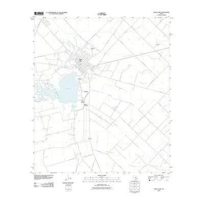
2010 Map of Eagle Lake
USGS Topo · Published 2010About this map
Eagle Lake dominates the central geography of this Colorado County region, surrounded by a network of drainage systems like West Bernard Creek and Gum Tree Branch. The town of Eagle Lake serves as the primary hub, where local routes like Old Altair Rd and S McCarty Ave converge near the western shore. The map illustrates a landscape of agricultural and industrial utility, including the Chesterville Oil Field to the northeast and the Silver Creek Fish Hatchery south of the main lake body. Genealogists will find the locations of Lakeside Cemetery and Mount Zion Cemetery helpful for tracing local family history, while the proximity of Rayner Junction and Lakeside suggests the historical importance of rail and road junctions in this part of Texas.
Find a feature on this map
44 named features on this map. Tap any name to fly to it.
Don’t see what you’re looking for? This feature index may not catch every label — zoom into the map to look around manually.
Map Details
Editions of this 2010 Eagle Lake Map
This is the sole edition of this map. No revisions or reprints were ever made.
Other maps of this area

1952 · Egypt
USGS Topo · 1:24,000

1953 · Seguin
USGS Topo · 1:250,000

1956 · Wallis
USGS Topo · 1:62,500

1957 · Eagle Lake
USGS Topo · 1:62,500

1957 · Altair
USGS Topo · 1:24,000

1958 · Seguin
USGS Topo · 1:250,000

1958 · Alleyton
USGS Topo · 1:24,000

1959 · Garwood
USGS Topo · 1:24,000

1959 · Bonus
USGS Topo · 1:24,000

1960 · Lissie
USGS Topo · 1:24,000