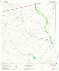
1963 Map of Eagle Lake NE
USGS Topo · Published 1982About this map
Attwater Prairie Chicken National Wildlife Refuge dominates this landscape along the Colorado and Austin county line, protecting critical habitat near the winding San Bernard River. The map captures a transition in land use, where cattle ranching and conservation coexist with the active Chesterville Oil Field in the southern sector. Industrial activity is further evidenced by several Gravel Pits and a Pumping Sta located north of Coushatta Creek.
Find a feature on this map
18 named features on this map. Tap any name to fly to it.
Don’t see what you’re looking for? This feature index may not catch every label — zoom into the map to look around manually.
Map Details
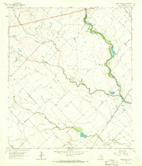
Editions of this 1963 Eagle Lake NE Map
2 editions found
Other maps of this area

1953 · Seguin
USGS Topo · 1:250,000

1956 · Bellville
USGS Topo · 1:62,500

1956 · Sealy
USGS Topo · 1:62,500

1956 · Wallis
USGS Topo · 1:62,500

1957 · Eagle Lake
USGS Topo · 1:62,500

1957 · Altair
USGS Topo · 1:24,000

1958 · Seguin
USGS Topo · 1:250,000

1958 · Bernardo
USGS Topo · 1:24,000

1958 · Alleyton
USGS Topo · 1:24,000

1960 · Lissie
USGS Topo · 1:24,000