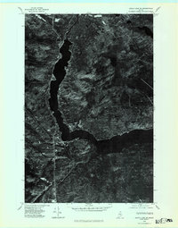
1975 Map of Eagle Lake SE
USGS Topo · Published 1981About this map
The waters of Eagle Lake and St. Froid Lake dominate this 1970s orthophotoquad, providing an unvarnished aerial view of the Northern Maine woods before modern expansion. This unique format uses rectified photoimagery taken in October 1975, revealing the exact footprint of the settlement at Plaisted and the town of Eagle Lake as they existed between the lake shores and the surrounding timberland. Unlike traditional line maps, this imagery captures the distinct texture of the forest floor, cleared agricultural fields, and the precise path of the Fish River connecting the deep basin of Blake Lake to the larger hydrological system. For historians and land use researchers, it provides a primary source for identifying old wood lots, private roads, and the specific density of structures along the primary thoroughfares during the mid-1970s.
Find a feature on this map
6 named features on this map. Tap any name to fly to it.
Don’t see what you’re looking for? This feature index may not catch every label — zoom into the map to look around manually.
Map Details
Editions of this 1975 Eagle Lake SE Map
This is the sole edition of this map. No revisions or reprints were ever made.
Other maps of this area

1927 · Square Lake
USGS Topo · 1:48,000

1928 · Eagle Lake
USGS Topo · 1:48,000

1928 · Winterville
USGS Topo · 1:48,000

1929 · Portage
USGS Topo · 1:62,500

1931 · Square Lake
USGS Topo · 1:62,500

1931 · Eagle Lake
USGS Topo · 1:62,500

1931 · Portage
USGS Topo · 1:62,500

1931 · Winterville
USGS Topo · 1:62,500

1953 · Square Lake
USGS Topo · 1:62,500

1953 · Portage
USGS Topo · 1:62,500