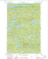
1960 Map of Eagle Mountain
USGS Topo · Published 1986About this map
Eagle Mountain dominates this portion of the Misquah Hills, marking a landscape defined by its complex network of lakes and drainage basins within the Boundary Waters Canoe Area Wilderness. This 1960 survey, updated in the mid-1980s, highlights a transition from managed timberlands to protected wilderness. An Old Railroad Grade north of Swan Lake provides a tangible trace of early 20th-century logging infrastructure that once penetrated these dense woods before the area was formally designated for preservation. Large water bodies like Winchell Lake and Brule Lake are mapped alongside smaller, descriptively named features like Footsteps Lake and Skidway Lake, reflecting the nomenclature of early travelers and foresters. The map also delineates the boundaries of the Superior National Forest and the Pat Bayle State Forest, showing the intersection of state and federal land management.
Find a feature on this map
69 named features on this map. Tap any name to fly to it.
Don’t see what you’re looking for? This feature index may not catch every label — zoom into the map to look around manually.
Map Details
Editions of this 1960 Eagle Mountain Map
3 editions found
Other maps of this area

1919 · Brule Lake
USGS Topo · 1:62,500

1954 · Two Harbors
USGS Topo · 1:250,000

1957 · Two Harbors
USGS Topo · 1:250,000

1957 · Quetico
USGS Topo · 1:250,000

1958 · Two Harbors
USGS Topo · 1:250,000

1959 · Lima Mountain
USGS Topo · 1:24,000

1959 · Hungry Jack Lake
USGS Topo · 1:24,000

1960 · Tait Lake
USGS Topo · 1:24,000
1960 · Devil Track Lake
USGS Topo · 1:24,000

1960 · Mark Lake
USGS Topo · 1:24,000