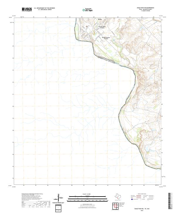
2022 Map of Eagle Pass SW
USGS Topo · Published 2022About this map
The Rio Grande serves as the prominent international boundary on this southwestern Texas survey, separating Maverick County from Mexico. Concentrated residential growth is visible in the northern portion of the sheet, where several colonial-style developments including Rosita Valley Colonia, Rosita Gardens Colonia, and the Riverside Acres neighborhood are clustered. These communities are accessed via a network of local roads such as Lisa Blvd, Rosita Valley Rd, and the primary artery FM 1021.
Find a feature on this map
24 named features on this map. Tap any name to fly to it.
Don’t see what you’re looking for? This feature index may not catch every label — zoom into the map to look around manually.
Map Details
Editions of this 2022 Eagle Pass SW Map
This is the sole edition of this map. No revisions or reprints were ever made.
Other maps of this area

1940 · Eagle Pass
USGS Topo · 1:62,500

1957 · Indio Creek
USGS Topo · 1:62,500

1958 · Eagle Pass
USGS Topo · 1:250,000

1965 · Eagle Pass
USGS Topo · 1:250,000
1982 · Eagle Pass NE
USGS Topo · 1:24,000
1983 · Eagle Pass East
USGS Topo · 1:24,000
1983 · Eagle Pass West
USGS Topo · 1:24,000
1983 · El Indio
USGS Topo · 1:24,000
1983 · Indio Creek
USGS Topo · 1:24,000
1983 · Eagle Pass SW
USGS Topo · 1:24,000
Featured Places
- Rosita, TX
- Riverside Acres Colonia, TX
- Loma Linda Ranchettes Colonia, TX
- Rosita Gardens Colonia, TX
- Rosita Valley Colonia, TX