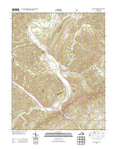
2013 Map of Eagle Rock
USGS Topo · Published 2013About this map
Eagle Rock sits at a geographic pivot point where the James River and Craig Cr converge, anchoring a corridor of historic river settlements. The landscape transitions from the river valley floors to the high elevations of Rathole Mountain and Crawford Mountain, with early transportation routes following the water's path. Smaller hamlets like Bessemer and Gala are linked by local connectors such as Bessemer Ln and Draft Rd, reflecting a rural infrastructure built around the river's bend. Aviation and community landmarks, including Perkey Airport and Phoenix Bridge, highlight the 21st-century configuration of these valley towns. To the east, the terrain rises toward Sheets Mountain, while named branches like Shirkey Mill Br suggest the industrial history of the waterways that once powered local milling operations.
Find a feature on this map
50 named features on this map. Tap any name to fly to it.
Don’t see what you’re looking for? This feature index may not catch every label — zoom into the map to look around manually.
Map Details
Editions of this 2013 Eagle Rock Map
This is the sole edition of this map. No revisions or reprints were ever made.
Other maps of this area

1894 · Natural Bridge
USGS Topo · 1:125,000

1894 · Natural Bridge
USGS Topo · 1:62,500

1907 · Natural Bridge Special
USGS Topo · 1:62,500

1913 · Eagle Rock
USGS Topo · 1:48,000

1915 · Eagle Rock
USGS Topo · 1:62,500

1945 · Clifton Forge
USGS Topo · 1:62,500

1946 · Millboro
USGS Topo · 1:62,500

1947 · Roanoke
USGS Topo · 1:250,000
1949 · Clifton Forge
USGS Topo · 1:62,500
1949 · Millboro
USGS Topo · 1:62,500