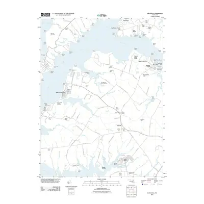
2011 Map of Earleville
USGS Topo · Published 2011About this map
The Elk River and Bohemia River converge near the Chesapeake Bay in this detailed survey of Cecil County's shoreline and rural interior. The landscape is defined by its deep maritime heritage and agricultural roots, visible in the numerous wharves and fisheries dotting the banks, such as Reybold Wharf and Collins Fishery. The interior is marked by historic farmsteads like Mount Pleasant Farm and Mount Harmon, alongside the central village of Earleville, where the Earleville Post Office serves the local community. For genealogists, the map preserves the locations of several burial grounds, including Saint Stephens Cemetery and Veazey Cemetery, which anchor the histories of the surrounding necks of land. Residential enclaves like White Crystal Beach and Hacks Point Acres illustrate the area's development as a waterfront destination, while landmarks like the Pearce Creek Disposal Area Dam reflect modern environmental management within this complex riverine geography.
Find a feature on this map
136 named features on this map. Tap any name to fly to it.
Don’t see what you’re looking for? This feature index may not catch every label — zoom into the map to look around manually.
Map Details
Editions of this 2011 Earleville Map
This is the sole edition of this map. No revisions or reprints were ever made.
Other maps of this area

1898 · Elkton
USGS Topo · 1:62,500

1898 · Tolchester
USGS Topo · 1:125,000

1899 · Dover
USGS Topo · 1:125,000

1900 · Elkton
USGS Topo · 1:62,500

1900 · Cecilton
USGS Topo · 1:62,500

1900 · Havre De Grace
USGS Topo · 1:62,500

1900 · Betterton
USGS Topo · 1:62,500

1903 · Tolchester
USGS Topo · 1:125,000

1906 · Dover
USGS Topo · 1:125,000

1908 · Tolchester
USGS Topo · 1:125,000