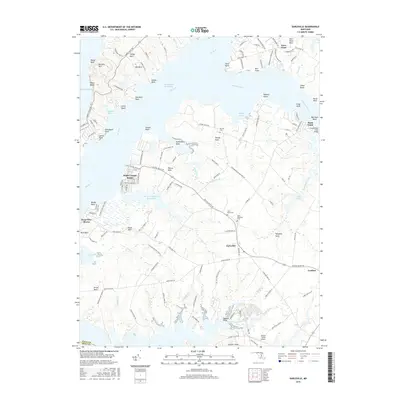
2016 Map of Earleville
USGS Topo · Published 2016About this map
Earleville sits at the heart of this landscape, a junction where agricultural land meets the complex waterways of the Upper Chesapeake. This 2016 survey shows the intricate geography of the Elk River and Bohemia River, where numerous necks and points such as Veazey Neck, Sassafras Neck, and Town Point Neck define the shoreline. The map reveals a mix of recreational and residential development at White Crystal Beach and West View Shores, contrasting with the more industrial and ecological character of the Pearce Cr Disposal Area Lake. Local history is preserved through numerous family-named landmarks and historical sites, including Veazey Cem and the adjacent Saint Pauls Cem and Saint Stephens Cem. The map provides a look at the road network connecting the interior of the peninsula to the waterfront, with features like the Scotchmans Creek Bridge and Hexton Farms Airport serving the area's transportation needs.
Find a feature on this map
134 named features on this map. Tap any name to fly to it.
Don’t see what you’re looking for? This feature index may not catch every label — zoom into the map to look around manually.
Map Details
Editions of this 2016 Earleville Map
This is the sole edition of this map. No revisions or reprints were ever made.
Other maps of this area

1898 · Elkton
USGS Topo · 1:62,500

1898 · Tolchester
USGS Topo · 1:125,000

1899 · Dover
USGS Topo · 1:125,000

1900 · Elkton
USGS Topo · 1:62,500

1900 · Cecilton
USGS Topo · 1:62,500

1900 · Havre De Grace
USGS Topo · 1:62,500

1900 · Betterton
USGS Topo · 1:62,500

1903 · Tolchester
USGS Topo · 1:125,000

1906 · Dover
USGS Topo · 1:125,000

1908 · Tolchester
USGS Topo · 1:125,000