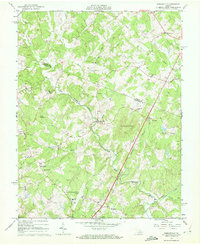
1965 Map of Earlysville
USGS Topo · Published 1972About this map
Earlysville anchors this mid-century survey of the Piedmont region, where the Greene and Albemarle County line divides a landscape shaped by the North Fork Rivanna River. The settlement pattern reflects a deeply rooted community of rural congregations and family burial grounds, including Buck Mountain Ch, Mt Zion Ch, and the Chestnut Grove Cem. Transport and industry are marked by the presence of Advance Mills and the Southern Railroad corridor near the South Fork Rivanna River in the south.
Find a feature on this map
46 named features on this map. Tap any name to fly to it.
Don’t see what you’re looking for? This feature index may not catch every label — zoom into the map to look around manually.
Map Details
Editions of this 1965 Earlysville Map
4 editions found
Other maps of this area

1892 · Gordonsville
USGS Topo · 1:125,000

1892 · Harrisonburg
USGS Topo · 1:125,000

1930 · Madison
USGS Topo · 1:48,000

1931 · University
USGS Topo · 1:62,500

1933 · Madison
USGS Topo · 1:62,500

1935 · Charlottesville
USGS Topo · 1:62,500

1935 · University
USGS Topo · 1:62,500

1937 · Elkton
USGS Topo · 1:62,500

1939 · Charlottesville
USGS Topo · 1:62,500

1949 · Charlottesville
USGS Topo · 1:250,000