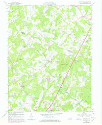
1965 Map of Earlysville
USGS Topo · Published 1978About this map
Earlysville and the surrounding Albemarle County countryside are defined by the winding course of the North Fork Rivanna River and its numerous tributaries. In the mid-1960s, this landscape was a network of rural crossroads and family-named landmarks, such as Frays Mountain and Piney Mountain. The presence of the Charlottesville-Albemarle Airport near the southern boundary signals the growing infrastructure of the region, while an old RR grade near the eastern edge provides a physical trace of earlier transportation routes.
Find a feature on this map
50 named features on this map. Tap any name to fly to it.
Don’t see what you’re looking for? This feature index may not catch every label — zoom into the map to look around manually.
Map Details
Editions of this 1965 Earlysville Map
4 editions found
Other maps of this area

1892 · Gordonsville
USGS Topo · 1:125,000

1892 · Harrisonburg
USGS Topo · 1:125,000

1930 · Madison
USGS Topo · 1:48,000

1931 · University
USGS Topo · 1:62,500

1933 · Madison
USGS Topo · 1:62,500

1935 · Charlottesville
USGS Topo · 1:62,500

1935 · University
USGS Topo · 1:62,500

1937 · Elkton
USGS Topo · 1:62,500

1939 · Charlottesville
USGS Topo · 1:62,500

1949 · Charlottesville
USGS Topo · 1:250,000