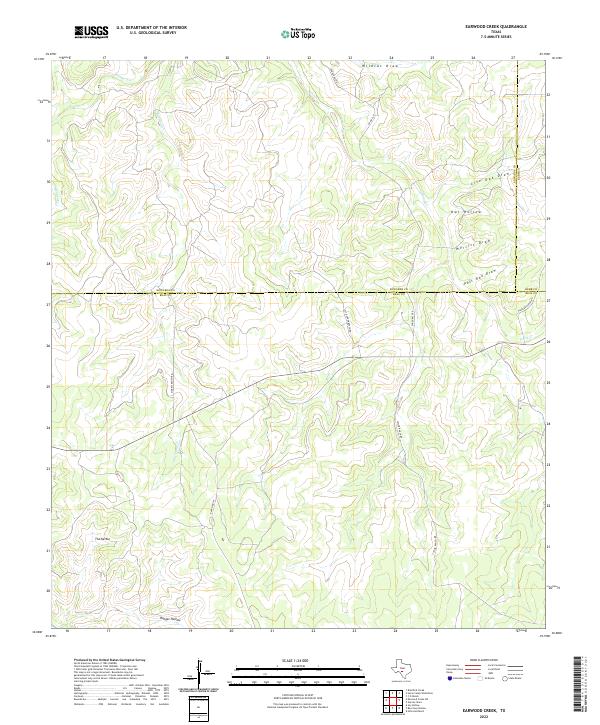
2022 Map of Earwood Creek
USGS Topo · Published 2022About this map
Earwood Cr and Hunger Cr carve through the limestone-cut landscape of the Edwards Plateau in this modern-era study of the Real County backcountry. The terrain is defined by a dense network of intermittent drainages and deep topographic depressions, most notably the circular formation known as The Kettle in the southwest and the expansive Ranger Hollow to the south. The mapping reveals a sparse ranching infrastructure where long-standing property lines are traced by routes like Morris Ranch Rd and Taylor Ranch Rd. This 2022 survey captures the intersection of three counties—Edwards, Real, and Kerr—marking a high-elevation divide where Wildcat Draw and Live Oak Draw head toward different watersheds. The lack of concentrated settlements highlights the enduring rural character of this portion of the Texas Hill Country, where land use remains centered on expansive ranching tracts and water-sculpted draws.
Find a feature on this map
21 named features on this map. Tap any name to fly to it.
Don’t see what you’re looking for? This feature index may not catch every label — zoom into the map to look around manually.
Map Details
Editions of this 2022 Earwood Creek Map
This is the sole edition of this map. No revisions or reprints were ever made.
Other maps of this area

1954 · Llano
USGS Topo · 1:250,000

1954 · San Antonio
USGS Topo · 1:250,000

1955 · Llano
USGS Topo · 1:250,000

1956 · Llano
USGS Topo · 1:250,000

1957 · San Antonio
USGS Topo · 1:250,000

1963 · Garven Store
USGS Topo · 1:24,000

1963 · Y O Ranch
USGS Topo · 1:24,000

1964 · Hillcrest Ranch
USGS Topo · 1:24,000
1971 · Bradford Creek
USGS Topo · 1:24,000
1971 · Earwood Creek
USGS Topo · 1:24,000