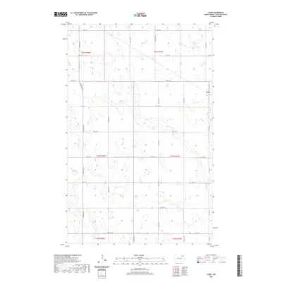
2020 Map of Easby
USGS Topo · Published 2020About this map
The settlement of Easby anchors the northeastern edge of this prairie landscape in Cavalier County, where the topography is defined by the winding course of the S Br Park River. This map illustrates the intersection of a rigid section-line road grid with the natural drainage of the Red River Valley upland. The S Br Park River cuts across the southeastern quadrant, creating the primary relief in an otherwise flat agricultural expanse. Local transportation is facilitated by a network of rural routes including Easby Rd and 106th Ave NE, which divide the land into the traditional township and range blocks of t161n r60w, t161n r59w, t160n r60w, and t160n r59w. The land use is dominated by prairie wetlands and small potholes, characteristic of the North Dakota drift plain.
Find a feature on this map
24 named features on this map. Tap any name to fly to it.
Don’t see what you’re looking for? This feature index may not catch every label — zoom into the map to look around manually.
Map Details
Editions of this 2020 Easby Map
This is the sole edition of this map. No revisions or reprints were ever made.
Other maps of this area

1953 · Devils Lake
USGS Topo · 1:250,000

1956 · Devils Lake
USGS Topo · 1:250,000

1967 · Langdon East
USGS Topo · 1:24,000

1969 · Olga SW
USGS Topo · 1:24,000

1970 · Langdon West
USGS Topo · 1:24,000

1972 · Osnabrock
USGS Topo · 1:24,000

1972 · Nekoma
USGS Topo · 1:24,000

1972 · Easby
USGS Topo · 1:24,000

1972 · Osnabrock SW
USGS Topo · 1:24,000

1972 · Billings Lake
USGS Topo · 1:24,000