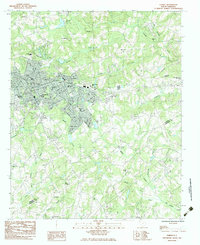
1983 Map of Easley
USGS Topo · Published 1983About this map
The town of Easley serves as the central hub of this 1983 survey, situated along the Southern railroad line at the border of Pickens and Anderson Counties. The map reflects a growing Piedmont community, with established residential areas like Forest Acres and Hamilton expanding outward from the commercial core near the Post Office and City Hall. Educational and social infrastructure is well-documented through a series of local schools, including the McKissick Sch and Simpson Sch, alongside prominent community landmarks such as the Greenville-Pickens Speedway.
Find a feature on this map
62 named features on this map. Tap any name to fly to it.
Don’t see what you’re looking for? This feature index may not catch every label — zoom into the map to look around manually.
Map Details
Editions of this 1983 Easley Map
This is the sole edition of this map. No revisions or reprints were ever made.
Other maps of this area

1888 · Pickens
USGS Topo · 1:125,000

1894 · Pickens
USGS Topo · 1:125,000

1935 · Greenville
USGS Topo · 1:48,000

1938 · Greenville
USGS Topo · 1:62,500

1954 · Greenville
USGS Topo · 1:250,000

1957 · Greenville
USGS Topo · 1:24,000

1957 · Anderson
USGS Topo · 1:62,500

1957 · Easley
USGS Topo · 1:62,500

1957 · Williamston
USGS Topo · 1:62,500

1957 · Greenville
USGS Topo · 1:62,500