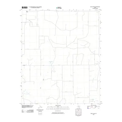
2010 Map of East Afton
USGS Topo · Published 2010About this map
East Afton and Croton anchor this corner of the Texas panhandle region, where the high plains begin to break into the drainage systems of the Brazos and Wichita basins. The landscape is defined by an intricate network of seasonal waterways and livestock watering holes, including Duncan Tank and Wichita Tank, which reflect the ranching heritage of Dickens County. Deep erosional features like Beef Hollow and Washout Creek cut through the terrain, illustrating the persistent force of water in this semi-arid environment. The drainage of Little Croton Creek and Boggy Creek in the southwest contrasts with the South Wichita River in the east. A rigid grid of farm-to-market roads, such as FM 193 and FM 265, and numerous numbered county roads provide the primary infrastructure for the scattered homesteads and agricultural operations that characterize the local geography.
Find a feature on this map
27 named features on this map. Tap any name to fly to it.
Don’t see what you’re looking for? This feature index may not catch every label — zoom into the map to look around manually.
Map Details
Editions of this 2010 East Afton Map
This is the sole edition of this map. No revisions or reprints were ever made.
Other maps of this area

1954 · Lubbock
USGS Topo · 1:250,000

1967 · Dickens North
USGS Topo · 1:24,000

1967 · Dickens South
USGS Topo · 1:24,000

1968 · East Afton
USGS Topo · 1:24,000

1968 · Pitchfork Ranch
USGS Topo · 1:24,000

1968 · Dumont
USGS Topo · 1:24,000

1968 · Croton Camp
USGS Topo · 1:24,000

1968 · East Afton NE
USGS Topo · 1:24,000

1968 · Sanders Hollow
USGS Topo · 1:24,000

1968 · Afton
USGS Topo · 1:24,000